Scott Aulen
Analytical thinker with a proven track record of successful project management and product development with a passion for doing good work that makes an impact.
Experience
Technical Consultant
Working within the Professional Services division, tasked with providing vision and leadership while promoting the use of Esri technology to enable customer success; daily operations involved managing technical scope of engagements by collaborating closely with clients to understand their geospatial needs.
Major Accomplishments
-Successful completion of 20+ projects for clients such as Army Corps of Engineers, Burns & McDonnell, City of Bellingham, City of Chicago, City of El Paso, City of Fort Worth, County of Los Angeles, FEMA, Indian Health Service, NY MTA, and Southern California Edision
-Contributor to internal Github repo representing division best practices and innovative solutions
Senior Product Engineer
Member of a 30-40 person team responsible for designing, developing, and deploying organization's premier geovisual analytics tools, ArcGIS Insights
Major Accomplishments
-Successfully led a 7 person team for the development of a significant feature update, ArcGIS Insights Report Designer
-Primary architect for the ArcGIS Insights Lab, an external facing resource center for users
-Onboarded 2 new hires which included daily communication, detailed tutorials, and content creation for team's onboarding wiki
GIS Analyst III
1 of 2 senior analysts responsible for advanced data analysis, data communication, and workflow management for all aspects of local government GIS operations
Major Accomplishments
-Developed multiple analytical tools across departments, for internal and external use.
-Created several data process workflows and reconfigured GIS open data process.
-Led the creation and adoption of internal department knowledge base
GIS Analyst II
Responsible for core municipal GIS functions across multiple departments and primary administrator of Web GIS portal
Major Accomplishments
-Redeveloped and managed best in class Web GIS portal supporting 50+ applications and 100+ internal users
-Created a 3D base model for Planning Department and conceived a data update process which was codified into development review process
-Promoted to GIS Analyst III
Interim Greenway Planner
Planner within Parks and Recreation Department working on greenway/open space planning, bike/ped planning, and Director assigned research projects
Education
Clemson University
Thesis Greenway Prioritization: Developing an Implementation Matrix for the City of Greenville, SC
Miami University
Skills
-Python
-Javascript
-HTML
-CSS
-SQL
-Power BI
-Tableau
-Google Analytics
-Integromat
-Inkscape
-GIMP
-SketchUp
-ArcGIS Suite
-MS Office
-Figma
Portfolio
Dashboard
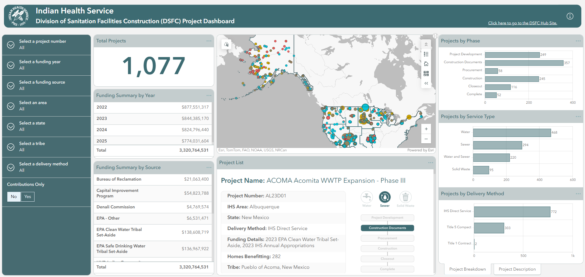
Designed, developed, and implemented public dashboard for Indian Health Service
View Project
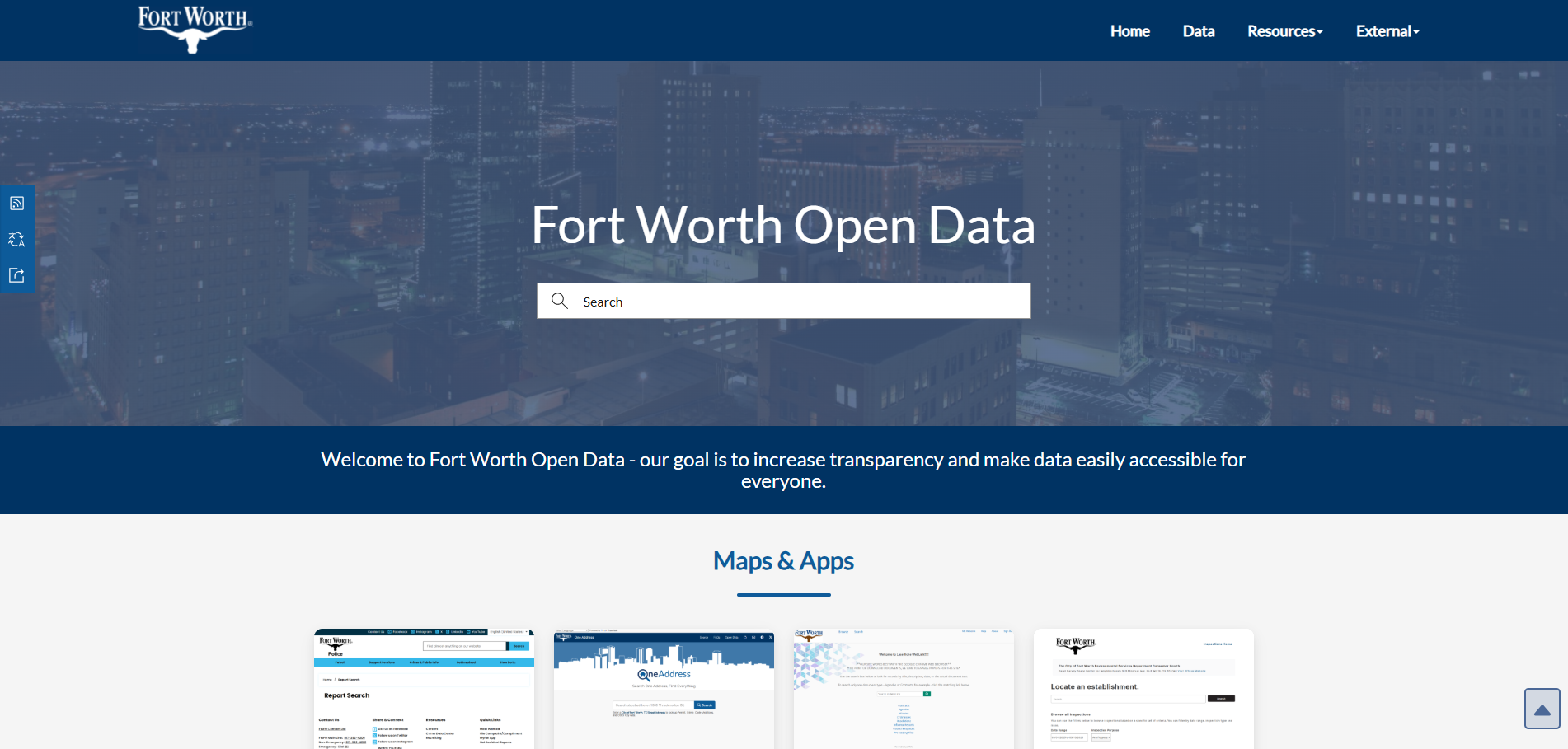
Open Data and Performance Hub
Designed, developed, and implemented data information hubs for the City of Fort Worth, TX
View Project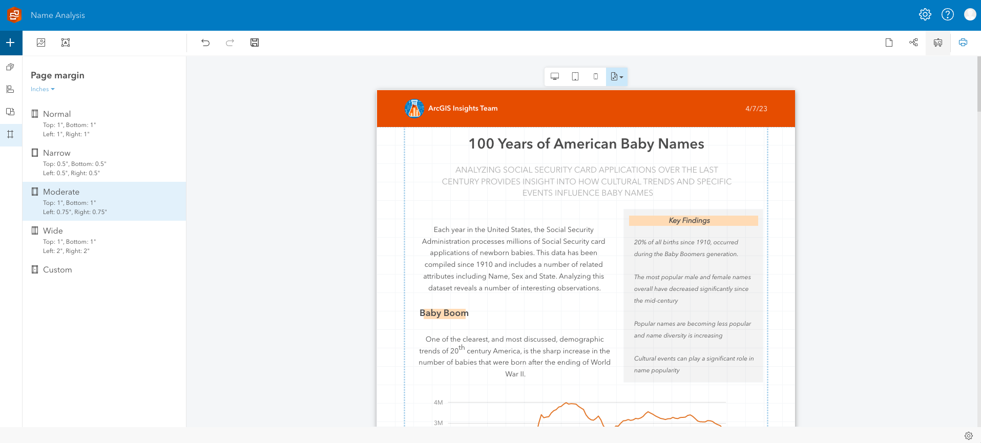
ArcGIS Insights Report Designer
Led a team of 7 to develop a report publishing feature for ArcGIS Insights, involving pitch proposal, scope planning, UI/UX design, and project management under a tight deadline
View Project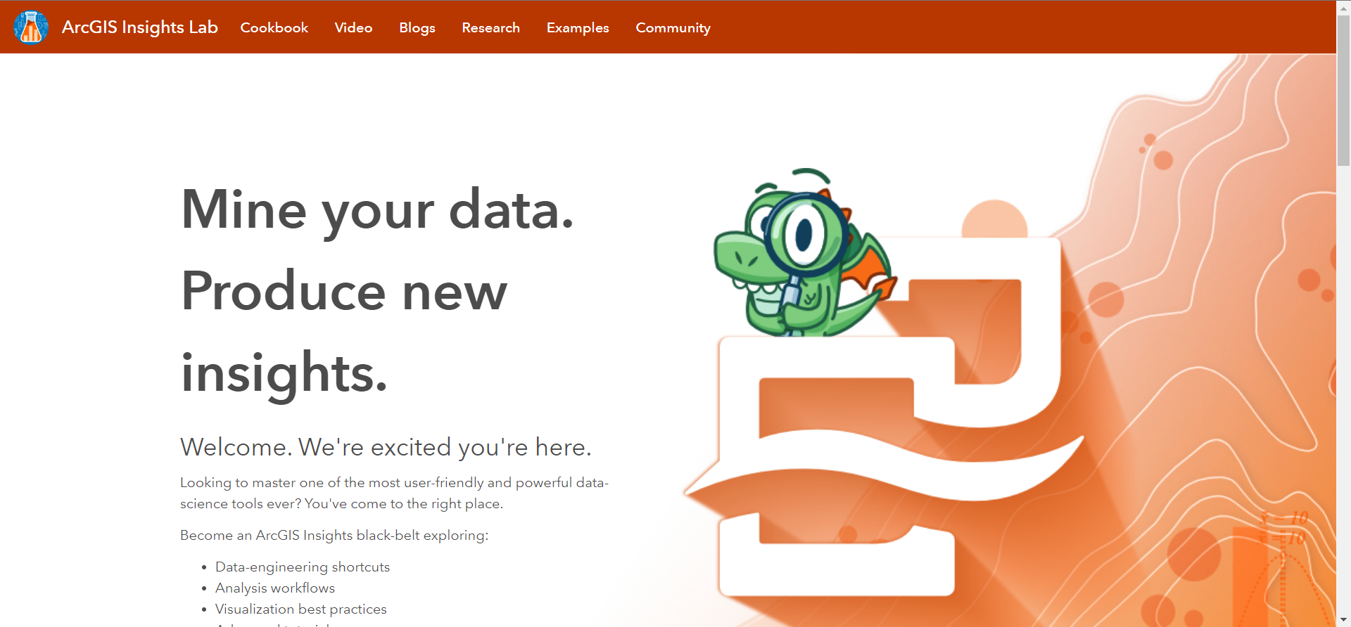
ArcGIS Insights Lab
Conceived and designed an external resource center for ArcGIS Insights users focusing on general knowledge, best practices, and advanced tips
View Project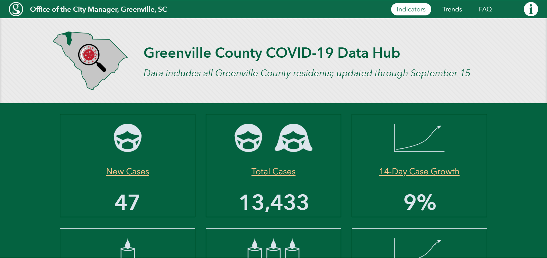
COVID Data Hub
Developed and maintained a community-centered data hub of COVID-19 indicators and trends
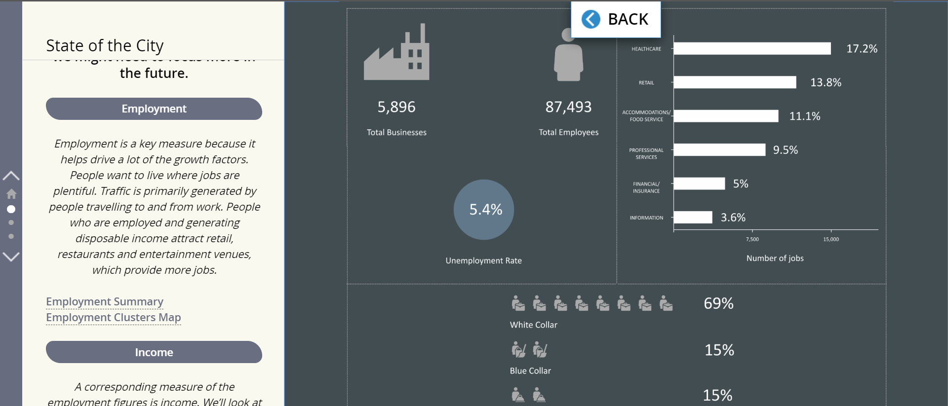
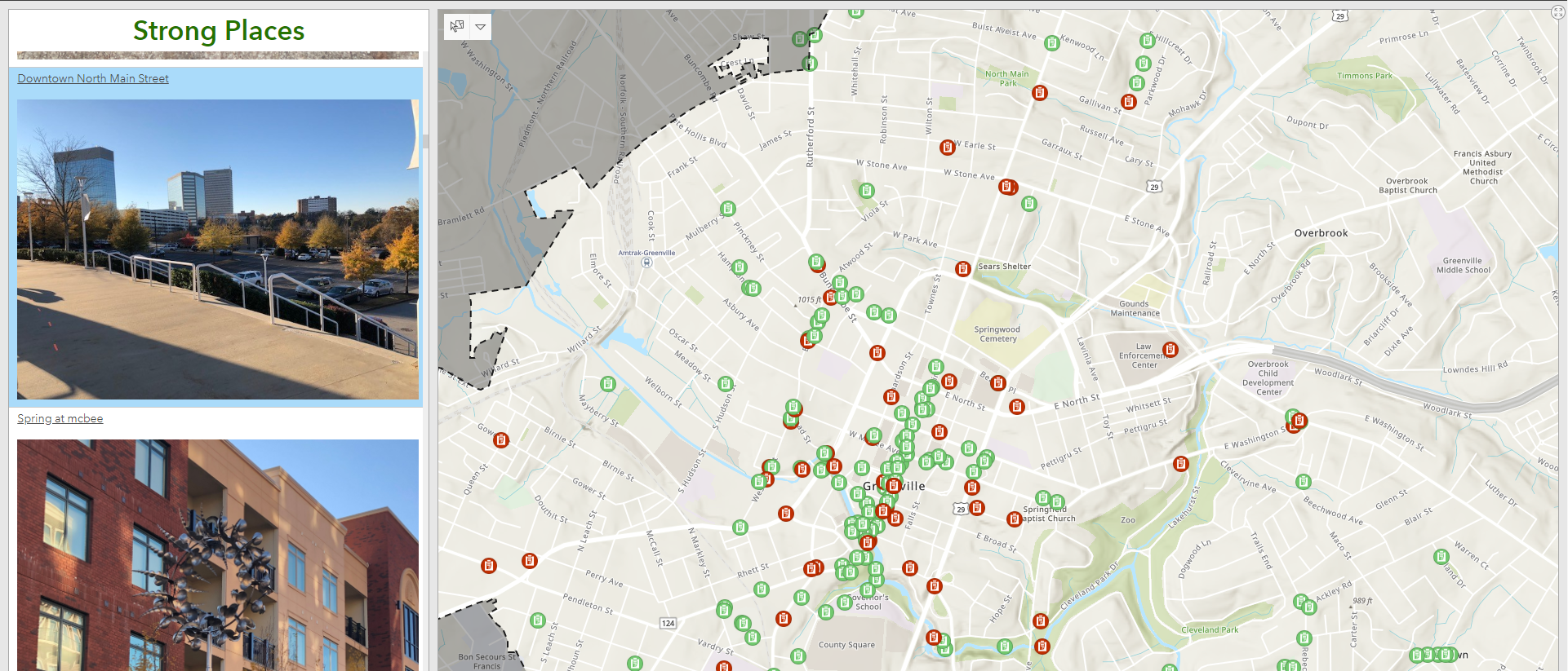
State of the City
Co-created a comprehensive analysis of current conditions designed to effectively communicate information to a non-technical audience
Executive Dashboards
Developed and implemented multiple interactive dashboards across departments (Community Development, Fire, Parks and Recreation, Planning, Police) aimed at providing decision makers with measurable metrics and insights
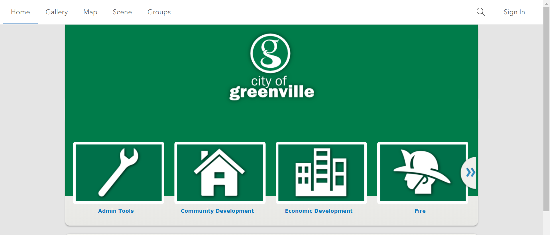
Enterprise Web GIS
Developed and administered internal/external Web GIS Portal supporting 50+ applications and 100+ internal users